hope it keeps on, keep n on up the coast
http://sat.wrh.noaa.gov/satellite/satlo ... vis&size=2
FoG fUn..
-
fearlu
- Resident

- Posts:965
- Joined:Thu Mar 04, 2004 9:24 am
- Contact:
-
Bulldog

- Old School

- Posts:1783
- Joined:Thu Jun 22, 2006 7:23 pm
- Contact:
-
narly1

- Regular

- Posts:540
- Joined:Tue Mar 07, 2006 7:36 am
- Location:alameda
- Contact:
aH-O..
check this out,
its time sesative
its 4'17 ocolck now..
the fogs pulled back....to s.d. or more, and left a small bloB///
not good for me
http://sat.wrh.noaa.gov/satellite/satlo ... vis&size=4
check this out,
its time sesative
its 4'17 ocolck now..
the fogs pulled back....to s.d. or more, and left a small bloB///
not good for me
http://sat.wrh.noaa.gov/satellite/satlo ... vis&size=4
Narly1
-
Proparoo
- Regular
- Posts:612
- Joined:Wed Mar 15, 2006 1:59 pm
- Location:Sacramento CA
- Contact:
Looking at NOAA's forecast... looks like the fog will return in the morning though it won't be too deep.
They are calling for wind in the Delta starting Friday and it looks like to could last till next weekend with cooler temps all through the week...
Should be 15 to 25mph this weekend with ebb from 7am till 2pm...
AREA FORECAST DISCUSSION
NATIONAL WEATHER SERVICE SACRAMENTO CA
230 PM PDT THU JUN 14 2007
.DISCUSSION...
TODAY LOOKS TO BE THE HOTTEST OF THIS STRETCH OF HEAT. IN
RESPONSE TO A WEAK LOW APPROACHING THE PACIFIC NW TONIGHT THE
BREEZE THOUGH THE DELTA SHOULD INCREASE THIS EVENING. THE BAD NEWS
IS THERE IS NO STRATUS ALONG THE COAST SO THE AMOUNT OF COOLING
WILL NOT BE AS GREAT AS IF WE HAD A SOLID STRATUS DECK OF CLOUDS
COOLING THE COAST. SACRAMENTO AND THE DELTA WILL BENEFIT THE MOST
BY THIS INCREASE IN WIND THROUGH THE DELTA BUT EXPECT ANOTHER WARM
NIGHT WITH ONLY SLIGHTLY COOLER TEMPERATURES FOR EVERYONE ELSE.
EXPECT ANOTHER HOT DAY ON FRIDAY WITH TEMPERATURES ONLY A FEW
DEGREES COOLER THAN TODAYS HIGHS. AS A TROUGH APPROACHES AND
DEEPENS OVER THE REGION FRIDAY NIGHT AND SATURDAY EXPECT COOLER
TEMPERATURES AND BETTER
FLOW THROUGH THE DELTA.
SATURDAY NIGHT INTO SUNDAY BEHIND THE TROUGH HIGHER SURFACE
PRESSURE BUILDS OVER WESTERN OREGON THAT SHOULD PRODUCE SOME
BREEZY CONDITIONS...PARTICULARLY OVER THE NORTHERN HALF OF THE
SACRAMENTO VALLEY AND OVER THE NORTHERN COASTAL RANGE.
TEMPERATURES SHOULD WARM UP AS WELL CLOSE TO 100 DEGREES FOR MANY
VALLEY LOCATIONS. TEMPERATURES LOOK TO REMAIN VERY WARM THROUGH
EARLY NEXT WEEK BEFORE GRADUALLY COOLING THROUGH THE MID TO LATTER
PART OF NEXT WEEK. BY THAT TIME PERIOD COASTAL STRATUS SHOULD
RETURN AS WELL AS LONG AS THE TROUGH JUST OFF THE WEST COAST OF
CANADA DEVELOPS AS CURRENTLY IS MODELED BY THE GFS.
Rich "ATOM" Baum
-
Proparoo
- Regular
- Posts:612
- Joined:Wed Mar 15, 2006 1:59 pm
- Location:Sacramento CA
- Contact:
Check out this link for Fairfield www.weather.com
http://www.weather.com/outlook/travel/b ... v_business
Calling for HIGH WINDS all week!!
http://www.weather.com/outlook/travel/b ... v_business
Calling for HIGH WINDS all week!!
Rich "ATOM" Baum
-
Hana

- Regular
- Posts:334
- Joined:Tue Jul 13, 2004 10:50 pm
- Location:Oakland
- Contact:
-
Bulldog
- Old School
- Posts:1783
- Joined:Thu Jun 22, 2006 7:23 pm
- Contact:
-
Proparoo
- Regular
- Posts:612
- Joined:Wed Mar 15, 2006 1:59 pm
- Location:Sacramento CA
- Contact:
Paul,
Where do you get the NORTH from? Sure it might be a bit from the North in Sacto but I think Sherman should be good.
I am calling it on shore from tomorrow on...
Actually it wind from North to WSW around 2 or 3pm today..
Sunday should be a great WSW day... We will have to wait and see..
Where do you get the NORTH from? Sure it might be a bit from the North in Sacto but I think Sherman should be good.
I am calling it on shore from tomorrow on...
Actually it wind from North to WSW around 2 or 3pm today..
Sunday should be a great WSW day... We will have to wait and see..
Rich "ATOM" Baum
-
narly1
- Regular
- Posts:540
- Joined:Tue Mar 07, 2006 7:36 am
- Location:alameda
- Contact:
fogs move n again......
http://sat.wrh.noaa.gov/satellite/satlo ... fog&size=4
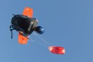
i hope to get a RidE..
come on BaBy,come to paPPa.
left me up and take me for a riDe
http://sat.wrh.noaa.gov/satellite/satlo ... fog&size=4
i hope to get a RidE..
come on BaBy,come to paPPa.
left me up and take me for a riDe
Narly1
Who is online
Users browsing this forum: No registered users and 6 guests