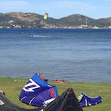
Ok as a 3rd kiter for more than 10 years I want to point out a topic up we like to ignore - or at best dont want to think about. The 3rd upper launch eroded dramatically over the years. Now, as google earth offers a time sider and a ruler I measured the beach length of their images 1993 to 2012.
So here we have the 93 image

- 93.jpg (57.25KiB)Viewed 10738 times
and here the 2012

- 2012.jpg (54.44KiB)Viewed 10738 times
now with the line tool I measured the minimum beach length of the cove to the stones. So we get this graph.

- 3rd plot.jpg (13.55KiB)Viewed 10738 times
We loose 9 meters per year. And quite linear. With the remaining 31 meters minimum we have till 2016 when the cove actually will touch the stones. We have to act either with the city or without. Now what do you think is the option of choice?
Best, Georg