looks like wind..
http://www.wrh.noaa.gov/mtr/
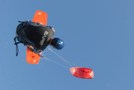
maybe ill even get to kite.
time for some lovin
-
narly1

- Regular

- Posts:540
- Joined:Tue Mar 07, 2006 7:36 am
- Location:alameda
- Contact:
-
Proparoo
- Regular
- Posts:612
- Joined:Wed Mar 15, 2006 1:59 pm
- Location:Sacramento CA
- Contact:
-
Bulldog

- Old School

- Posts:1783
- Joined:Thu Jun 22, 2006 7:23 pm
- Contact:
-
fearlu
- Resident

- Posts:965
- Joined:Thu Mar 04, 2004 9:24 am
- Contact:
No wind anywhere? How might we explain the wave riding at Waddell today? (Z? GB?) Seemed windy enough to ride some big honkin' waves to me! (But, I acknowledge Paul, that it didn't seem very good on the pager and it was pretty light overall.) Still got some salt in the eyebrows though! No BIG jumps to be had, but definitely some 3D water. All-in-all worth the drive.
Folsom on Wednesday then?
Folsom on Wednesday then?
Go bigga'
-
Greg
- Old School
- Posts:3516
- Joined:Fri Mar 05, 2004 6:45 pm
- Contact:

-
Proparoo
- Regular
- Posts:612
- Joined:Wed Mar 15, 2006 1:59 pm
- Location:Sacramento CA
- Contact:
-
Proparoo
- Regular
- Posts:612
- Joined:Wed Mar 15, 2006 1:59 pm
- Location:Sacramento CA
- Contact:
Well It does look like a good forcast,
We will just have to see how it plays out...
Good luck to you all, I won't be able to make it... :(
.STO WATCHES/WARNINGS/ADVISORIES... ....RED FLAG WARNING IN EFFECT FROM 9 PM TONIGHT THROUGH 3 PM WEDNESDAY AFTERNOON FOR ALL AREAS EXCEPT THE NORTHERN SAN JOAQUIN VALLEY...THE STANISLAUS NATIONAL FOREST AND THE SOUTHERN MOTHERLODE. ....HIGH WIND WARNING IN EFFECT FROM 9 PM THIS EVENING TO 3 PM PDT WEDNESDAY FOR ALL OF SHASTA COUNTY...THE BURNEY BASIN...THE COASTAL RANGE...AND THE NORTHEAST FOOTHILLS AS WELL AS THE NORTHERN SIERRA. ....A WIND ADVISORY IN EFFECT FROM 9 PM THIS EVENING TO 3 PM PDT WEDNESDAY FOR THE SACRAMENTO VALLEY...THE DELTA...AND LAKE SOUTHERN COUNTY...INCLUDING CLEAR LAKE.
Rich "ATOM" Baum
-
Bulldog
- Old School
- Posts:1783
- Joined:Thu Jun 22, 2006 7:23 pm
- Contact:
-
Proparoo
- Regular
- Posts:612
- Joined:Wed Mar 15, 2006 1:59 pm
- Location:Sacramento CA
- Contact:
5:50 am Sherman Windtalker is already 14 to 29 with an ave. of NW 21
Nothing yet at Folsom...
Looking at the below forcast it looks like they have downgraded it :(
--------------------------------------------------------------------------------
AREA FORECAST DISCUSSION
FXUS66 KSTO 251134 AFDSTO AREA FORECAST DISCUSSION NATIONAL WEATHER SERVICE SACRAMENTO CA 430 AM PDT WED OCT 25 2006 .DISCUSSION... SATELLITE IMAGERY SHOWS SHARP TROF MOVING QUICKLY INTO NEVADA EARLY THIS MORNING. WINDS PEAKED DURING THE NIGHT AS DRY SURFACE COLD FRONT MOVED ACROSS THE REGION SUPPORTED BY SOME DOWNWARD MOMENTUM FROM ALOFT.
EXPECT THAT WINDS WILL PICK UP AGAIN IN THE SACRAMENTO VALLEY AFTER SUNRISE AS MIXING OF THE BOUNDARY LAYER DEVELOPS... HOWEVER WHILE BREEZY CONDITIONS WILL DEVELOP...IT LOOKS LIKE SPEEDS FOR THE MOST PART WILL REMAIN BELOW ADVISORY CRITERIA AS LARGE-SCALE SUPPORT FOR STRONG WINDS ACTUALLY WEAKENS WITH TIME AS THE TROF MOVES FURTHER TO THE EAST. THE TIGHT SURFACE GRADIENT IS EXPECTED TO TRANSITION TO AN EASTERLY DIRECTION TONIGHT AS SURFACE HIGH PRESSURE BUILDS INTO THE GREAT BASIN IN THE WAKE OF THE TROF. THIS WILL SHIFT THE FOCUS OF GUSTY WINDS TO THE NORTHERN SIERRA AND FOOTHILLS WHERE LOCALLY GUSTY EAST WINDS WILL OCCUR ACROSS THE HIGHER TERRAIN AND DOWN THE CANYONS ON THE WEST SLOPES. PORTIONS OF THE COAST RANGE AND THE WEST SIDE OF THE SACRAMENTO VALLEY WILL ALSO LIKELY SEE BREEZY CONDITIONS CONTINUE TONIGHT.
Rich "ATOM" Baum
-
fearlu
- Resident
- Posts:965
- Joined:Thu Mar 04, 2004 9:24 am
- Contact:
Who is online
Users browsing this forum: FaceBook [Linkcheck] and 7 guests